|
(click on the photos to see them enlarged) |

|
All the way down
to
Bambarakanda Waterfalls from Horton Plains |
|
We started at Peradeniya at
5.00 am and reached the trail head, which was about 9 km from the Visitor
Centre at Horton Plains towards Ohiya, at 11.00 am.
I know six hours to do a distance that was just a little over 100 km was
totally unacceptable considering the facts our hired van was so... good, the
driver was so... cool, road was so... private, and what was more, we all
wanted to get to the trail head as early as possible. The point was one ought
to be blindfolded to go from Peradeniya to Horton
Plains via Nuwereliya, Ambewale
and Pattipola and not stop one's vehicle at least
at a few of the numerous locations of enticing beauty. One such gripping location was at Horton Plains itself placed between the Pattipola-side entrance and the Visitor Centre (Photo 1).
Our view was shades of blue peaks surrounding the geometrically symmetric |
|
|
|
|
|


|
Photo 1: Distant
blue hills on the Sri Pada side of Horton Plains |
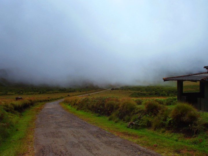
Photo 2: Mist
covered ambience on the Ohiya side of Horton Plains |
Photo 3: Abiramy
at the trail head and the van in the background |
Photo 4: Abiramy
and Sarath hiking in the misty tea plantation |
|
Travelling about 7 km towards Ohiya
from the Visitor Centre, we reached the Ohiya-side
entrance to Horton Plains. Travelling yet another 2 km along the same
direction, we reached the much anticipated trail head on our right. The trial
was a wide non-paved road which met the Horton Plains-Ohiya
road (B508) at right angle (Photo 3). Since our trail was well known to be
totally unsuitable for the van, after unloading us and our hiking gears, the
van went via Ohiya, Borelanda,
Haputale and Kalupahana
to get to Bambarakanda Rest (the trail end) and
await us there. Abiramy, the youngest member of our
crew (Photo 3) was with her pretty red rubber slippers
throughout the hike and was extremely comfortable with them. So much so, I am
contemplating on doing the same on my next hike. We started our hike, at about 11.00 am, from an
elevation of 2040 m, enveloped by the gentle mist. Even though it was
thoroughly disappointing to realize the possibility of walking through a
panoramic landscape adjoining Horton Plains without ever seeing not more than
20 to 30 m from our noses (Photo 4), it must be said here that the gentleness
in which those clouds welcomed us and the softness in which they carried us
through have no parallel to quote from our everyday lives in the city. As a
matter of fact, I have read somewhere that the mist is one of the essentials
for a healthy life, as drinking lots of water and eating plenty of fruits and
vegetables. I am beginning to realize that there is some truth in it since my
otherwise sensitive bronchial tubes are so very pleased with themselves
whenever I walk though the mist even if it is going uphill along the steep
slopes of Sri Pada in the soporific hours, even for
the guardians of the forest. The trail was full of sharp bends and we were
descending on the side of a mountain crested with cropped tea plants. We leisurely
hiked about 1.5 km and reached a T-junction at which we continued straight ahead
without taking the left turn. Sarath (wearing white
cap in Photo 4) always does the ground work before our hike such as acquiring
laminated coloured printouts of the 1-inch topographical map of the trail and its
surroundings. It is a great feeling to stand at an insignificant bend on
our route facing a majestic, lonely mountain and to locate that bend on the
map and the name of the mountain whose lap we are in. By the way, when we
were home bound and dozing in the van, Sarath got
the delightful news about his promotion to grandfather-ship; a hike never to
be forgotten by Sarath and a birth never to be
forgotten by us. One
of the greatest things about hiking on foot is meeting, greeting and chatting
with the people to whom our exploring ground is home. A lady collecting
firewood was our first acquaintance in that sense. I was delighted to chat
with her freely in colloquial Tamil. She was not surprised to hear about our
mission. However, she chuckled when I asked her how long it would take us to
get to the Bambarakanda falls. She went like, Hm.., at
your rate, it would definitely be late evening, say 4 or 5. We took her estimation very
seriously and changed our mind about ordering for our late lunch at the Bambarakanda Rest, as planned. We decided to snack at
whatever we had with us for lunch and take the dinner
at Nuwereliya. That turned out to be a very wise
decision, indeed. Lesson:
Always listen to the locals when in a strange location. Continuing
our hassle-free hike along the meandering trail in the misty tea plantation,
3 km from the trail head, at about 12.30 pm, we arrived at the Ohiya-Kalupahana Colonial Trek which laid at right angle
to our trail (Photo 5). By this time, the mist had cleared to some extent and
we started to see far and wide (Photos 5 and 6). We walked about 50 m towards
Ohiya for a good view of the unfolding panorama
(Photo 6). Entranced by the shades of colours that rolled out ahead of us,
under the partially lifted misty curtain, we were much tempted to continue
our hike in the direction of Ohiya along the
Colonial Trek. Perhaps next
time, we told ourselves. It is fitting to mention here that we met two able young men at this location and they were walking from Ohiya to Kalupahana on some business, and not on pleasure. They told us that it took them 45 minutes to get to that point from Ohiya and that they would be at Kalupahana within another hour or two. They offered to take us with them, but we politely declined because we did not think that our leg muscles would match those of the locals. The road up to that point was pretty decent for a hiker
and the rolling stones under the feet appeared only as we got near the Bambarakanda falls. |
|
|
|
|
|


|
Photo 5: Our trail meeting the Ohiya-Kalupahana Colonial Trek |
Photo 6: South-east from the Ohiya-Kalupahana
Colonial Trek |
Photo 7: Gayan and Anuradha
at the start of the Devils Staircase |
Photo 8: Ishak at the rapids after passing the Devils Staircase |
|
The start of the Devils Staircase could clearly be
identified by the start of the concrete road uphill (Photo 7). A few sharp
turns and an appreciable elevation gain coupled with precipitous edge linings
are the characteristics that must have earned the notorious reputation for
the Devils Staircase. As we were on foot and walking uphill on a wide
concreted track, some of the crew members had not even
noticed that they went passed one of the most anticipated excitements of the
hike. By the way, we also met a cow grazing at the edge of the Devils
Staircase, which was indeed not so devilish for those on foot. As we passed
the Devils staircase, we came across the signboard (not a signstone)
on the left reading Udaveriya Estate, West Haputale
Division. Walking another few hundreds meters
or so, we reached the second rapids coming down on our right and the second
well-managed bridge (Photo 8). No sooner than passing the rapids, we come to a
point where the sign read Agarapatana Plantations Ltd, Udaveriya and another
Y-junction. We kept to the left. After hiking another couple of hundred
meters, we entered the dreamland. Glorious sceneries unfolding in the
mist-less ambient towards the southern |
|
|

|
Photo 9: Panoramic view towards the south
under the rolling clouds boarded by the multi coloured shrubs on the left and
lush green tea plantation on the right |
|
Continuing our hike in the grand ambience, we came to a picturesque bend in the track with the view to the virgin forest on the sharp edged mountain range (Photo 10) which, I guessed, stationed itself in the gap between us and the precipitous drops of the small and big World's Ends at Horton Plains. To the right of the bend was the plain luxury abode of the Kanakapillai', who was revered by the simple folks (Photo 11) labouring at the surrounding tea plantations with whom we chat away for a while on Ishak's fact-finding initiation. We realized words such as A/L and university had very distant meaning for them. Trekking along and meeting several inhabitants of the township, young and old, in an otherwise dreamland, we reached an irresistible location at about 3.00 pm (Photo 12). Taking a long break there, we chat, laughed and had our lunch which included cakes, biscuits, other tit bits and the infamous kurakan roti' with the delicious seeni sambol'. A few hundreds meters from there, we reached the unique township at Yelatenne (Photo 13) surrounded by a number of virgin forest crusted peaks that were 2000 m high and above, including Gonmolikanda to our left, in the gap between us and the Worlds Ends of Horton Plains. |
|
|
|
|
|


|
Photo
10: The
picturesque enviable luxuries of the township of the estate workers |
Photo 11: The simple possessions of the township inclusive of a tireless van |
Photo 12: Wasantha (left), Senarath (middle) and Sarath at our lunching location |
Photo 13: The temple getting ready for its much awaited festival at Yelatenne |
|
The township at Yelatenne appeared a
richer one in a comparative sense and its livelihood did not depend entirely
upon tea. The most educated lad there had done his O/L, living with his uncle
at Badulla. He had been told by his three elder
brothers that working at tea plantations was not for someone as educated as
he was. For those lads (Photo 14) with no generous uncles living close to proper' schools, schooling beyond Year 5 was
not only a distant but also a luxury affair because of the location of Yelatenne
right in the middle of Ohiya-Kalupahana Colonial Trek which
could be traversed either by foot or by a glamorous 4WD. At a distance from
the township, there were streams flowing down (Photo 15) from which water
supply to the town was provided with some clever engineering and a lot of
hardship. Construction of a mini-hydro power plant for the township had been
completed to a great extent by an NGO and the final stages of which were not
concluded owing to lack of funds, as we were told. I could not help thinking
very seriously to get there to educate those kids on weekend basis or
something for that I need to get my
4WD first. A kilometre or so passing Yelatenne, the
much anticipated rain, though not so very welcomed, descended upon us first a few drops on a sunny sky and then a moderately cold shower
with a foggy curtain enveloping us. We continued on, with rain coats and
umbrellas, and at about 4.15 pm, we reached the location where the stream
feeding the Bambarakanda falls crosses the 4WD trek
(background of Photo 16). Because of the volume of water and the force at
which it was crossing the trek, we chose the narrow metal bridge to go over
the stream. Continuing, we reached the V-cut (1408 m high) at about 4.45 pm
(Photo 17). The rain had ceased by now. The visibility continued to remain
far reduced, anyways. By now we had hiked 9 km from the
trail head. |
|
|
|
|
|


|
Photo 14: A lad at play with his home made toy
at Yelatenne |
Photo 15: Kirthi and myself flanked by Gayan and Ishak at Yelatenne |
Photo 16: Reaching the stream feeding the falls in the rains |
Photo 17: Passing the misty V-cut in between two showers |
|
From then onwards, we went nearly downhill walking on rolling stones under our shoes and, of course, slippers. Along our trail, we had several sightings of the powerful Bambarakanda falls through her misty veil. The first such sighting was awesome not only because I had waited for that moment for a long time but also we came all the way from Horton Plains on foot to sight her. That was indeed exhilarating. In another hour or so, hiking through tree-lined trails, passing a few partially constructed homes featuring limited affluence, some of us reached the Bambarakanda Rest (1142 m high and about 11.5 km from the trail head), where our van was awaiting us. Some of our crew members had, fortunately, missed the location of the Rest and had, enviably, walked up to the best location (1056 m high and about 12 km from the trail head) to sight the majestic beauty of the Bambarakanda falls. I changed into dry cloths and got into the van with the remaining crew and we moved towards the popular location to absorb the beauty of the Falls. Alas, the rain started to thrash so very heavily as we approached the trendy location that I wavered about getting out of the van lest my cloths got wet again. What I saw through the rain pounding windows was gripping there she was, or is, free-spirited, wild, graceful, flowing down with shear force having detached herself from her stately, weather-beaten, immortal companion. I said to her I will come again ma'am for I have not had enough of you. |
|
|


|
Let me conclude the travelogue with the two most memorable photos of
the hike. To the left, it is Abiramy, the one with
the wild heart, at the V-cut exposing herself to the elements of Nature
during the tiny break between two heavy showers. She was holding Senarath's jacket that he had lent her to protect her
seemingly fragile stature from the drenching rain despite him having had a
severe fever just a few days before the hike and, what was more, no spare jacket.
To the right, the Mother Nature herself showing off one of her wildest
chattels; Bambarakanda Waterfalls the tallest in - August 2010 |
|
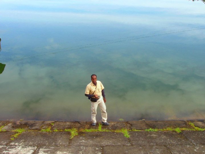
Photographs 5, 8, 10 and the
photo of Abiramy at the V-cut (above left) were
taken from the facebook album of Gayan
(below left, at Kande Ela
reservoir) and Photographs 1, 2, 12, 15, 16, 17 and the photo of Bambarakanda falls (above right) were taken from the facebook album of Eranda Anuradha (below right, by the first rapids as we
started on the Ohiya-Kalupahana Colonial Trek).
Thanks Gayan and Eranda Anuradha for sharing the photographs of the hike. The
rest of the photos were taken by Kirthi (my hubby)
and myself. |
|
|

|
Abiramy, the youngest member of the crew and of hiking, was very lively throughout the hike. Often, she took off her not-so thick jacket to expose herself further to the cold weather that penetrated through her thin blouse which thrilled her a lot. Gayan is
the prime inspiration for us to take all these hikes for no rain, no cold,
perhaps not even a cyclone, could make him change his mind once the hike date
is fixed. He was one of the photographers of the crew. His passion is going
uphill and not so much going downhill. If the route to Eranda Aruradha is very original, a great listener and says something only if it is absolutely necessary to say it. He was also one of the photographers of the crew. Ishak thinks aloud. Along our hiking trail, he discussed with the serenity of a philosopher religion, mathematics, politics, education and the cleverness of the roots that crack the rock walls of a study mountain only to fall silent at the plight of the estate walkers hugging on to their meager livelihoods for generations in that no man land far away from schools, hospitals and other basic accessories of modern civilizations. Senarath is an experienced hiker and have had the unique experience of having been lost in the Thotupola Kanda Nature Trail with his wife of their fresh marriage in a born chilling night of February. It appeared they were occupying the honeymoon ground of a leopard couple and that thrilling story must be told in some other place. He paints on paper as well as on wood (buring it to create lovely paintings). Wasantha is the silent enlightened type and a skilled painter and a creative writer. Sarath is a wonderful companion to have on the hike. He is lively, witty and thoughtful. He always does the ground work before our hike such as acquiring laminated coloured printouts of the 1-inch topographical map of the route and its surroundings. Kirthi never gets tired on a hike and was one of the photographers of the crew. If not for him, many of us in the crew would (happily, perhaps) get lost in our hikes. He's got many hobbies such as TaiChi, Chigun, Painting (not the walls, mind you), and so on. Shanthini, the author of the travelogue, was one of the
photographers of the crew as well. |
|
Uploaded on August 15, 2010 |